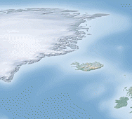
 Open, free and public. Three terms, which when appearing before the word “GIS” make geographers feel all warm and fuzzy (I think?). Geospatial data can be very costly, but free alternatives may be suitable, if not as useful, as their expensive counterparts. Therefore, its worthwhile knowing what data is available for public consumption. I have compiled a list of the open GIS data resources that I frequently make use of in my personal projects. Hopefully they become as useful to you, as they are to me.
Open GIS Data
Available in a variety of styles, open GIS data is worthwhile exploring before taking the plunge with expensive alternatives.
Natural Earth
Natural Earth is a public domain map dataset available at 1:10m, 1:50m, and 1:110 million scales. Featuring tightly integrated vector and raster data, with Natural Earth you can make a variety of visually pleasing, well-crafted maps with cartography or GIS software. All versions of Natural Earth raster + vector map data found on their website are in the public domain.
http://www.naturalearthdata.com/
CloudMade
Extracts of the Planet OpenStreetMap package. Various geographic extents and plenty of formats, including shapefiles, osm, adobe illustrator and more.
http://downloads.cloudmade.com/
Global Administrative Areas
GADM is a spatial database of the location of the world’s administrative areas (or administrative boundaries) for use in GIS and similar software. Administrative areas in this database are countries and lower level subdivisions such as provinces, departments, bibhag, bundeslander, daerah istimewa, fivondronana, krong, landsvæðun, opština, sous-préfectures, counties, and thana.
US Census Bureau - TIGER/Line Database
Extracts from the Census Bureau’s MAF/TIGER database, containing features such as roads, railroads, rivers, as well as legal and statistical geographic areas. Does not include demographic information but does include geographic id markers that can be linked to US Census data.
http://www.census.gov/geo/www/tiger/
National Weather Service - GIS Shapefile Database
Data includes weather, hydrological, city and urban, state/province and other libraries. This is a shapefile clearinghouse, one of the many sites that you will encounter that contain large amounts of un-manicured GIS data. The data often come from many sources, therefore we cannot be certain that all data will be of the same quality.
http://www.nws.noaa.gov/geodata/
City of Toronto - Open Data
The City of Toronto makes data it collects available to the public via toronto.ca/open. By offering data sets for others to use, the City supports unfiltered access to its information. Applications created using City data provide potential benefits for everyone. The goal over time is to offer all data allowable by law through toronto.ca/open.
Government of Canada - Open Data Pilot Project
The Open Data Pilot is part of the Government of Canada’s commitment to open government, which is being pursued along three streams: open data, open information and open dialogue, and aims to drive innovation and economic opportunities for all Canadians.
GeoNames
The GeoNames geographical database covers all countries and contains over eight million placenames that are available for download free of charge. Data incudes placenames as well as postal codes.
GeoBase
GeoBase data are governed by the GeoBase Unrestricted Use Licence Agreement. With this licence, users are granted a non-exclusive, fully paid, royalty-free right and licence to exercise all intellectual property rights in the data. This includes the right to use, incorporate, sublicense (with further right of sublicensing), modify, improve, further develop, and distribute the data; and to manufacture and/or distribute Derivative Products.
GeoGratis
GeoGratis is a portal provided by the Earth Sciences Sector (ESS) of Natural Resources Canada (NRCan) which provides geospatial data at no cost and without restrictions via http or ftp requests.
http://geogratis.cgdi.gc.ca/geogratis/en/index.html
Enjoy!
If this post helped you and you enjoy my site I would happily accept Litecoin donations:
LKPfT772e9HxvXYcA8LVDctTmENoqQxQF3

Fix the page is not working properly
I create a comment when I like a post on a site or I have something to contribute to the discussion. It’s triggered by the
 And, if you are writing on additional online social sites, I would like to keep
fire communicated in the post I browsed. And on this article Free and Open GIS data resources
| Spatial Analysis. I was actually excited enough to drop a thought :
-) I actually do have a couple of questions for
you if it’s okay. Is it only me or does it look like some of these
remarks look like they are written by brain dead visitors?
up with anything new you have to post. Would you make a list
all of your communal pages like your Facebook page, twitter feed, or linkedin profile?