
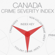
Work­ing with the Crime Sever­ity Index has been an inter­est­ing exer­cise. The data are avail­able through Sta­tis­tics Canada, which tracks police-reported crime sever­ity as well as the vol­ume of reported crimes. The Crime Sever­ity Index offers a sec­ondary mea­sure that helps us to under­stand more about the crimes com­mit­ted per Province. Gen­er­ally speak­ing, sever­ity of crime is not cor­re­lated with the vol­ume of crime com­mit­ted, but there are cer­tainly some out­liers. We inherit the inabil­ity to deter­mine whether or not these cor­re­la­tions actu­ally prove to be true when study­ing data aggre­gated to such a large (Provin­cial) extent. Con­tinue reading »

 After hav­ing seen the many iter­a­tions of the global con­nec­tiv­ity map, I have decided to give it a try myself. The maps are being pro­duced using