 It has been a while since I posted on this website; but you may have noticed that I have been fairly busy elsewhere, such as on LinkedIn or Twitter.
This post will stand as a reminder to myself that we can’t always foresee the bumps along the road. I am speaking about the ESRI mapbook submission that was due on November 16, which I missed because of undue difficulties in obtaining and manipulating trivial data. Why do I say trivial? Given the way my submission looks at the moment, I would say it is acceptable, if not near perfect for the mapbook categories of transportation and cartography.


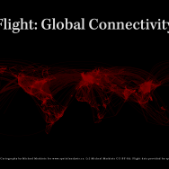
 After having seen the many iterations of the global connectivity map, I have decided to give it a try myself. The maps are being produced using