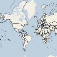
 Late last year, Google announced that their Maps API and Google Maps Imagery would become a charged service for high volume users. Anyone hosting more than 25,000 daily map views would incur charges according to this pricing scheme. It is important to note that, not only is the API restricted, but the imagery (google maps layers) is restricted in the same fashion. For those that use any other API but still call upon Google base layers, the restriction of 25,000 daily map views still holds true. Now, this website certainly won’t generate that kind of traffic anytime in the near future, but there certainly are those kinds of websites on the internet that have well over a million page views a day. Those that first come to mind are travel service providers and real-estate agencies. Both services use maps as spatial decision support tools (eg. where should I live? where should we visit?). I am taking this opportunity to round up the APIs that I am familiar with and would recommend to those making the move away from Google.
Mar 102012
Aug 222011
 An interesting form of cartography to say the least! Typographic maps have been around for some time, and only recently was I exposed to the concept. Perhaps my favourite (and quoted by many) are the maps produced by Axis Maps. They produce some of the most jaw-dropping typographic representations of cities that I have ever seen. I particularly like their use of white space (and by use, I mean there isn’t much white space left untouched!). Which leads me to the point of this post. I have been toying with the idea of producing some Continue reading »
