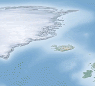
 Open, free and public. Three terms, which when appearing before the word “GIS” make geographers feel all warm and fuzzy (I think?). Geospatial data can be very costly, but free alternatives may be suitable, if not as useful, as their expensive counterparts. Therefore, its worthwhile knowing what data is available for public consumption. I have compiled a list of the open GIS data resources that I frequently make use of in my personal projects. Hopefully they become as useful to you, as they are to me. Continue reading »
Sep 192011
Sep 022011
 After having seen the many iterations of the global connectivity map, I have decided to give it a try myself. The maps are being produced using this data, which offers public air-traffic data in tabular format. The data is available in three categories: airports, airlines and routes. The airports and routes data can be manipulated, combined and cleaned-up to create a complimentary table that lists the longitude and latitude of each flights origin and destination. This allows us to connect each flight origin and destination. However, straight lines of Continue reading »
